Colorado and the Art of Geography
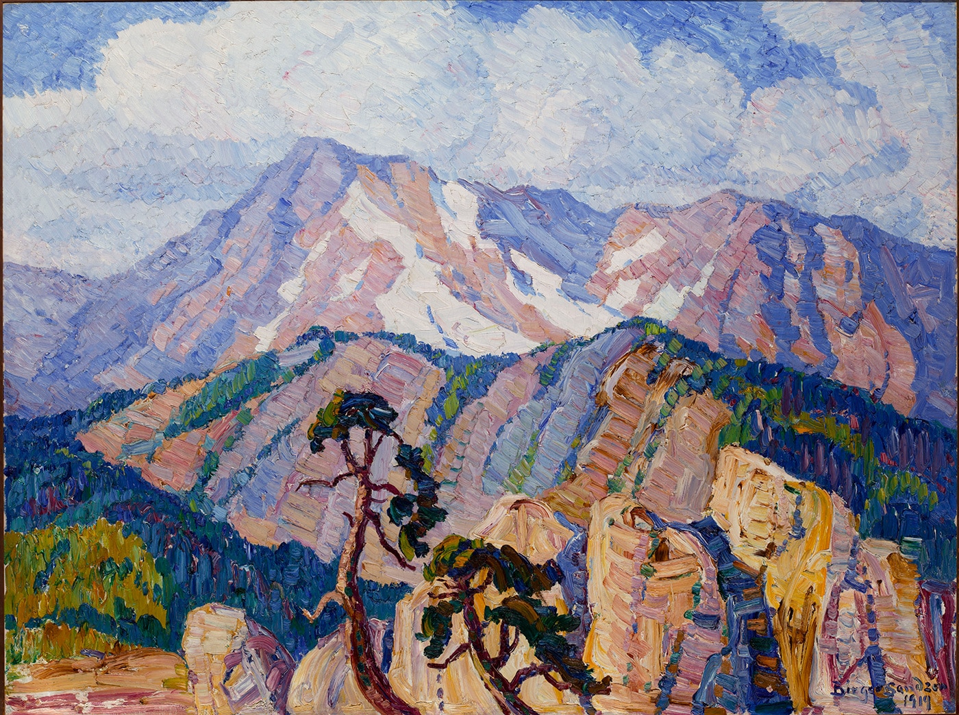
Birger Sandzén, Glimpse of Rocky Mountain National Park, 1919.
Swedish born Sandzén first visited the Rockies in 1908. He returned every summer for 15 years, creating landscapes using thick paint in very bold, bright, color combinations.
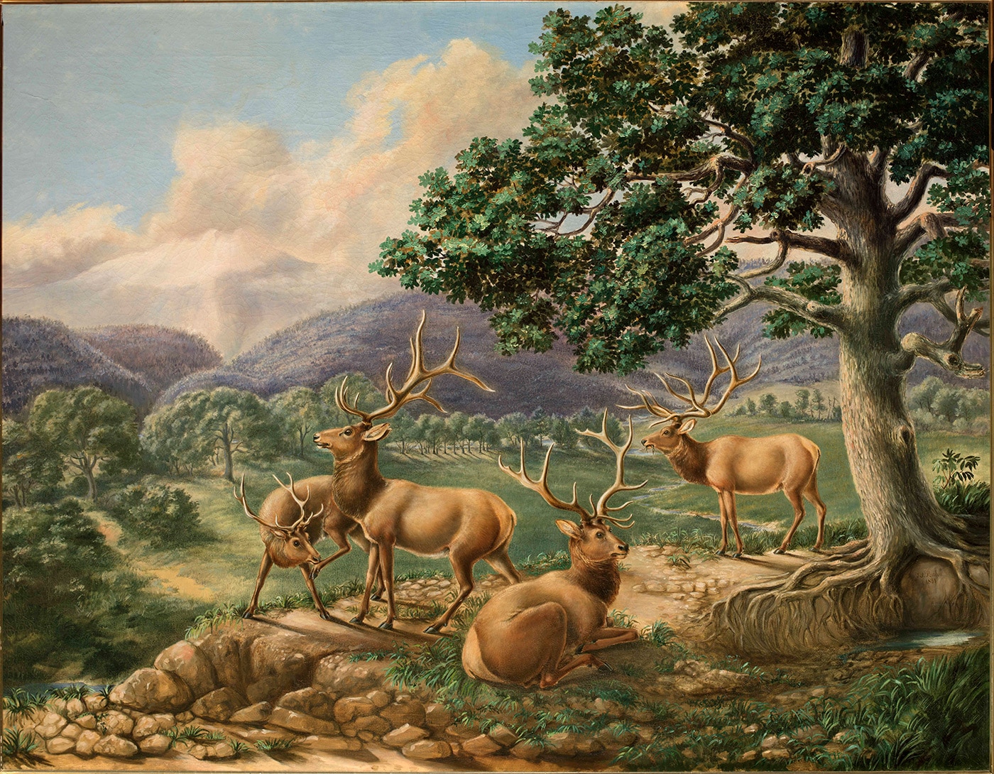
Titan Ramsey Peale, Four Elk, 1851.
Titian Ramsay Peale was the assistant naturalist on a topographical expedition of the Rocky Mountains led by Major Stephen Long from 1819 to 1820. This group of explorers was the first to officially climb Pike’s Peak in Colorado Springs.
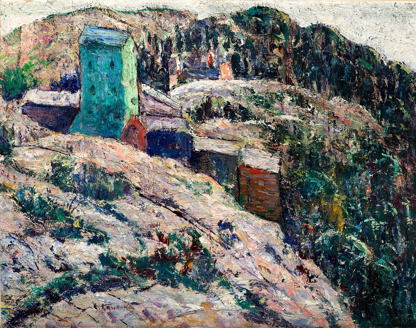
Ernest Lawson, Abandoned Mine, 1927.
Ernest Lawson taught art in Colorado Springs, which became a center for creative inspiration from around 1919-1935. Gold production in Colorado peaked in 1900. While some mines in Colorado are still active, the majority of them were closed and abandoned by the 1920s. Lawson still found beauty in the isolation and overgrown evidence of abandoned mines as the symbols of once-bustling communities.
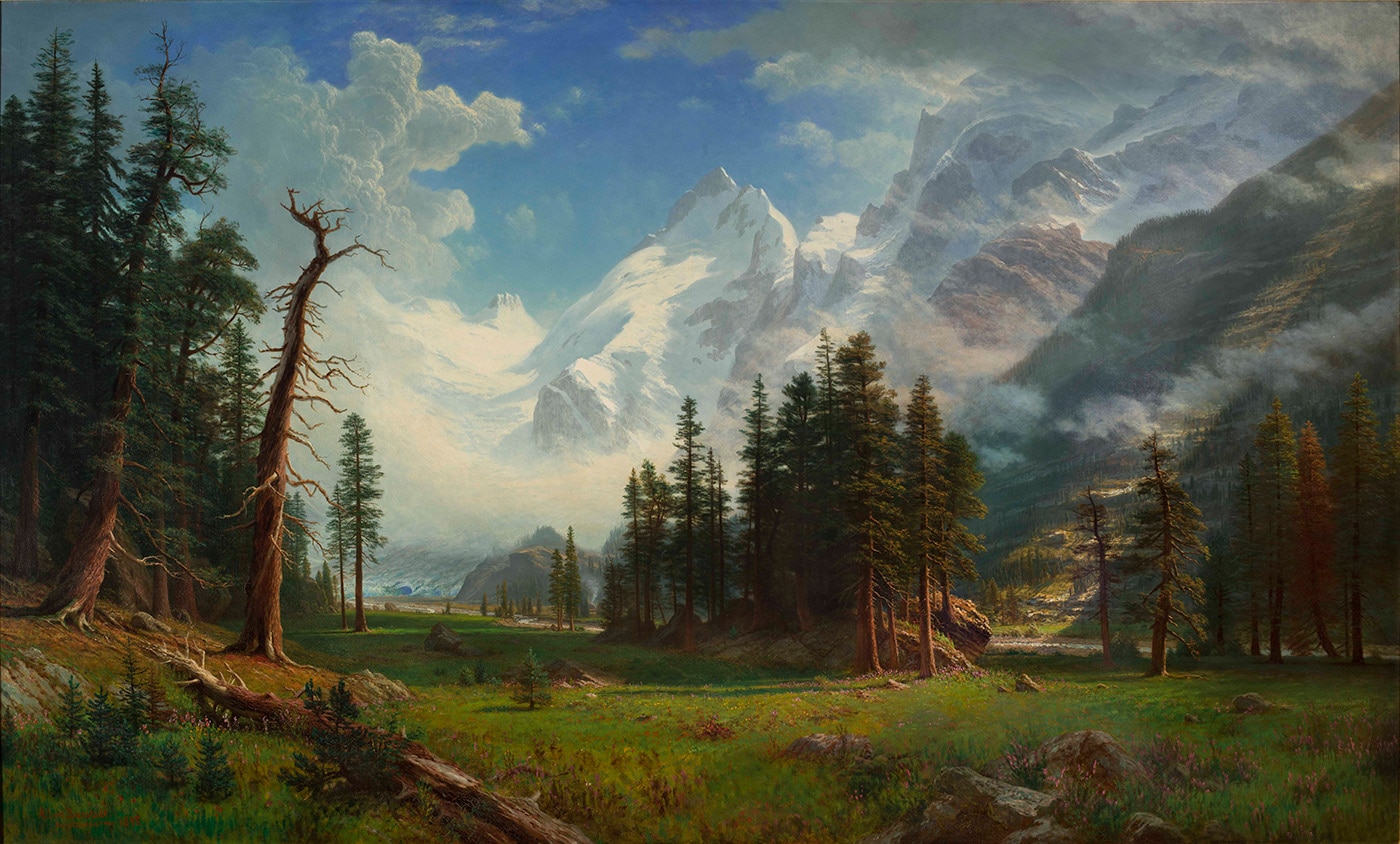
Albert Bierstadt, Mountain Landscape, 1895.
Albert Bierstadt traveled throughout Colorado on several occasions, hiking long distances and through rough landscapes to seek the most striking views. One of Colorado's 14ers is named after the artist.
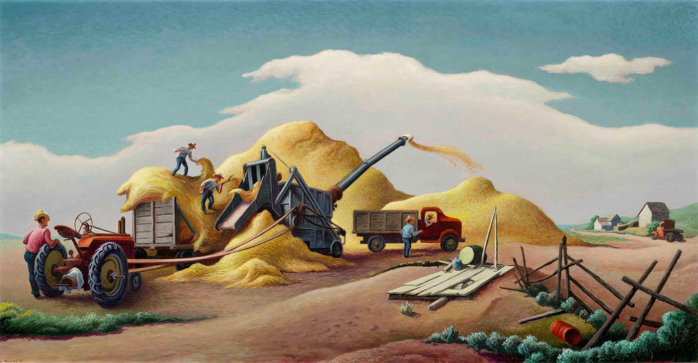
Thomas Hart Benton, Wheat Threshing on the High Plains, 1969.
For more information on this painting visit: https://education.anschutzcollection.org/living-in-the-american-west/
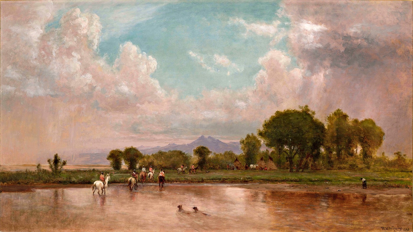
Worthington Whittredge, On the Plains, Cache La Poudre River, 1865.
In 1865-66 Worthington Whittredge traveled through Colorado with an inspection tour of the Missouri Territory led by General John Pope. He returned two more times, in 1870 and in 1871.
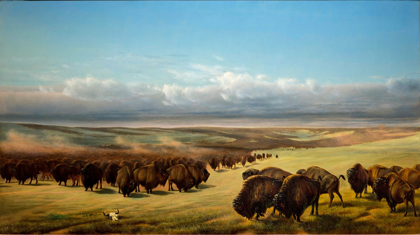
William Jacob Hays, The Gathering of the Herds, 1866.
For more information on this painting visit: https://education.anschutzcollection.org/artists-and-nature/
Background Information
At the beginning of the 19th century, lands west of the Mississippi, east of the Pacific Ocean, and north of the Rio Grande went through major political, environmental, and demographic changes in less than 100 years. In 1800 the bulk of the land that is now Colorado, the traditional home of many Native American tribes, was politically controlled by France and New Spain. France’s claims to the land ended with the Louisiana Purchase of 1803, and in 1848 Mexico surrendered its claims to the remaining parts of the state. The borders of Colorado were finally fixed in 1850, and the population boomed several times as gold was discovered in Denver, Cripple Creek, and several other sites. Colorado was admitted to the union as the 38th state on August 1, 1876.
Look Closer
Take a look at the American Museum of Western Art’s paintings of historic Colorado. Notice the diverse features of the landscape, including rugged mountains, desert canyons, vast plains, waterways, and mesas. Notice what natural resources (plants, animals, and waterways) are visible, and compare those with the man-made or mined resources you see in the artwork. Artists portrayed Colorado’s grandeur in paintings, and contributed to the nation’s interpretation of the state’s lands and resources. Several sites in Colorado are even named after artists who painted them. For example, the fourteener, Mount Bierstadt, is named after one of the first artists to hike, sketch, and paint the breathtaking scene from its peak, Albert Bierstadt.
Maps are created to capture the unique geography of the region, to show the best overland or water routes to get from point to point, or to show the distribution of natural and man-made resources. They can also illustrate important historic, political, cultural, or social sites. Using the paintings above as inspiration, think about how you would make a map to represent the unique features represented by the artwork.
Discussion Questions
- How does art represent physical space? How do maps represent physical space?
- How can art and maps show change over time?
- How are art and maps connected?
- How can maps help people understand history?
- How can maps help people understand art?
- Are maps art?
- What characteristics, regions, or resources will you focus on when you create your own map?
- What materials will you use to make a map?
- What materials will represent the characteristics or resources (Symbols)?
- How will people know what your symbols mean? Do you need a key?
Activity
Using discussion around historic paintings that depict Colorado, students will work to create an artistic textured topographic map of the state using found objects. Add the characteristics of each region, important political, social, and cultural sites, or research natural and man-made resources. The types and variety of work shown above can help direct the content of the maps students create.
Supplement the discussion with maps and research materials to deepen the outcomes of students’ content represented on their maps. Check out our resources below for more ideas!
Suggested Materials (per map):
• CO Base rectangle (cardboard, foam core, etc.)
• Fabric swatches of different textures and colors
• Beads, dried beans or lentils, noodles
• Ribbons, thread
• Egg-crate sections
• Cotton balls
• Greenery
• Pom-poms
• Glue or tape
• Markers, crayons, colored pencils
Grade levels: P-12 CO Standards
Visual Arts (2020)
Preschool 1.1 ; 2.1 ; 3.1 ; 4.1
Kindergarten 1.1 ; 2.1 ; 3.1 ; 4.1
1st Grade 1.1 ; 2.1 ; 3.1 ; 4.1
2nd Grade 1.1 ; 2.1 ; 3.1 ; 4.1
3rd Grade 1.1 ; 2.1-2 ; 3.1 ; 4.1
4th Grade 1.1-2 ; 2.1-2 ; 3.1-2 ; 4.1
5th Grade 1.1-2 ; 2.1-2 ; 3.1-2 ; 4.1
6th Grade 1.1-3 ; 2.1-2 ; 3.1-2 ; 4.1-3
7th Grade 1.1-3 ; 2.1-2 ; 3.1-3 ; 4.1-3
8th Grade 1.1-3 ; 2.1-2 ; 3.1-3 ; 4.1-2
High School 1.1-3 ; 2.1-3 ; 3.1-3 ; 4.1-3
Social Studies (2020)
Preschool 1.1 ; 2.1 ; 4.1
Kindergarten 1.1-2 ; 2.1-2
1st Grade 1.1-2 ; 2.1-2 ; 3.1 ; 4.1-2
2nd Grade 1.1-2 ; 2.1-2 ; 3.1
3rd Grade 1.1-2 ; 2.1 ; 4.1
4th Grade 1.1-2 ; 2.1-2 ; 3.1 ; 4.1
5th Grade 1.1 ; 2.1-2
6th Grade 1.1-2 ; 2.1-2
7th Grade 1.1
8th Grade 1.1-2 ; 2.1-2 ; 3.1
High School 1.1-3 ; 2.1-3 ; 3.1-2
Reading, Writing and Communicating (2020)
Preschool 2.1-2 ; 2.1 ; 4.1
Kindergarten 1.1-2 ; 3.1 ; 4.1
1st Grade 1.1-2 ; 4.1
2nd Grade 1.1-2 ; 4.1
3rd Grade 1.1-2 ; 4.1
4th Grade 1.1-2 ; 4.1
5th Grade 1.1-2 ; 4.1
6th Grade 1.1-2 ; 4.1
7th Grade 1.1 ; 4.1
8th Grade 1.1 ; 4.1
9th/10th Grade 1.1 ; 4.1
11th/12th Grade 1.1-2 ; 4.1
Science (2020)
2nd Grade 2.2 ; 3.2
4th Grade 3.1,3-4
Middle School 2.5-7,9 ; 3.3-5,8-11
High School 2.12-13 ; 3.3,8-11
Resources
Maps of Colorado
https://digitalcollections.nypl.org/items/72de1ac0-1fc9-0136-f72d-69b917c9ac23
https://libguides.colorado.edu/c.php?g=484941&p=3317173
http://blogs.denverpost.com/library/2015/05/28/vintage-1952-map-shows-colorados-classic-tourist-drives/10361/
https://geology.com/topographic-physical-map/colorado.shtml
http://coloradogeologicalsurvey.org/mineral-resources/industrial-minerals/
Downloads